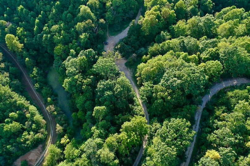
The Land
This is the substrate.
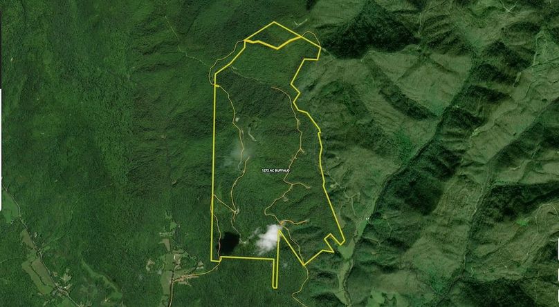
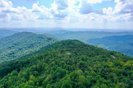
18,000+ contiguous acres on Tennessee’s Cumberland Plateau. Two counties. One ridge. Active rail. Active wells. Active mines. Silica sand verified at 98.52% SiO₂. Estimated geological value: approximately $11 billion.
Every number on this page is categorized. Every document is available. Every constraint is disclosed.
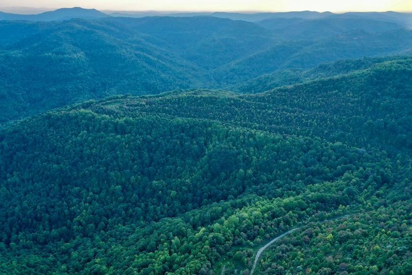
Elk Valley tract · Campbell County, Tennessee
About these numbers.
The numbers on this page fall into four categories. We are explicit about which is which before you read further.
Cash-flowing revenue
Revenue from active oil and gas wells and ongoing timber harvest. Independently verifiable through production records. This money comes in today.
Acquisition basis
The price we are paying for the land under the LOI with Ketchen Holdings LLC. Contractually documented. This is the cost floor.
Estimated in-ground geological value
Third-party estimates of the gross geological resources on the property — silica sand, coal reserves, oil and gas, timber, clay, stone. These are professional estimates at current commodity prices. They are not a guarantee of recoverable value. The current estimate is approximately $11 billion in gross in-ground value across all resource classes. We are explicit that this is an estimate, not a commitment of extractable revenue.
Projected infrastructure coverage
The percentage of Phase 1 infrastructure costs expected to be covered by federal and state grant programs. Based on current program rules, preliminary eligibility review, and comparable project awards in the region.
Whenever we cite a number on this site, we tell you which category it belongs to.
Where it is.
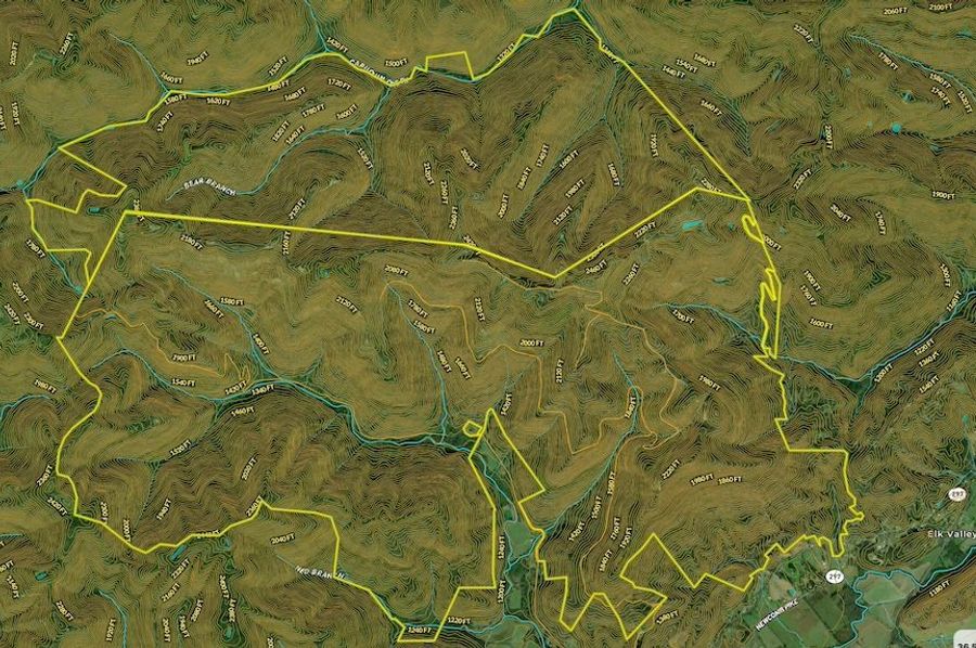
Pioneer, Tennessee. Cumberland Plateau. Spanning Campbell and Scott Counties. Active CSX rail runs through the property.
Knoxville
90 minutes
Nashville
3 hours
Chattanooga
3 hours
Atlanta
4 hours
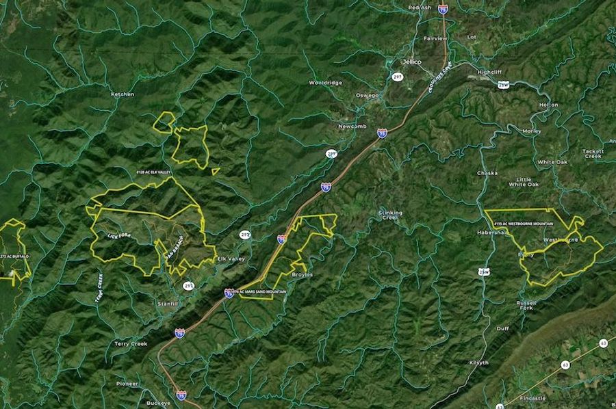
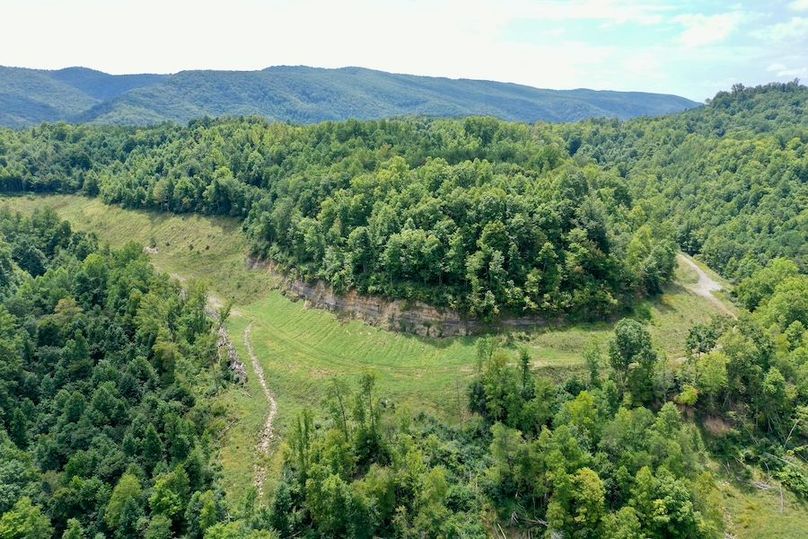
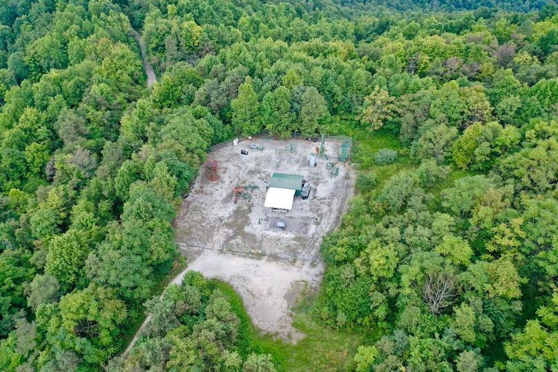
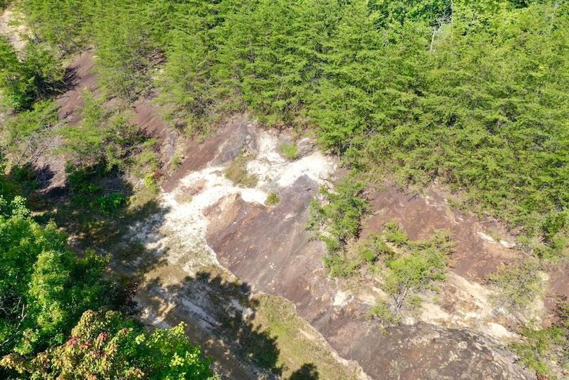
What is on it.
| Asset | Detail | Category |
|---|---|---|
| Silica sand | 75–150M tons estimated, 98.52% SiO₂ | In-ground, verified by 3 labs |
| Coal reserves | 161M tons proven (IRTEC survey) | In-ground, verified |
| Coal mines | Pre-existing underground infrastructure at 55°F | Physical, verified |
| Oil & gas wells | 27 active, cash-flowing | Cash-flowing, verified |
| Hardwood forest | 15,000+ acres of standing timber | Cash-flowing (ongoing harvest) |
| Railroad | CSX main line through property | Physical, verified |
| Water | Springs + 50+ in/yr rainfall | Physical, verified |
| Clay | Multiple deposits across site | Surveyed |
| Stone | Native sandstone throughout | Physical, verified |
What it unlocks.
Every resource on the property maps to a capability the city needs. Nothing is decorative.
Silica sand → Materials
98.52% SiO₂ is the feedstock for glass, solar panels, semiconductors, and advanced ceramics. The city manufactures its own building materials.
Mines → Compute
Pre-existing underground chambers at a constant 55°F. Natural cooling for data center infrastructure without the energy cost of surface cooling.
Rail → Movement
Active CSX main line through the property. Raw materials in, finished goods out, without trucking dependency.
Wells → Cash flow
27 active oil and gas wells generating revenue today. The land pays for itself while the city is being built.
Timber → Structures
15,000+ acres of standing hardwood. Sustainable harvest for construction lumber, CLT panels, furniture, and fuel.
Water → Agriculture
Natural springs and 50+ inches of annual rainfall. Gravity-fed irrigation. No water scarcity on this site.
The numbers, categorized.
- •Total acreage: 18,000+ contiguous acres (verified via survey)
- •Estimated in-ground gross geological value: approximately $11 billion (third-party estimates across all resource classes at current commodity prices; see disclosure above)
- •Silica sand deposit: 75–150M tons, 98.52% SiO₂ (in-ground, verified by 3 independent labs)
- •Coal reserves: 161M tons proven (in-ground, IRTEC survey)
- •Current annual revenue from wells and timber: approximately $215,000 (cash-flowing, verifiable from production records)
- •Estimated Phase 1 infrastructure cost: approximately $8 million (internal estimate)
- •Projected federal and state grant coverage of Phase 1 infrastructure: 50–80 percent (projection based on current program rules)
- •Tennessee utility district formation cost: approximately $15,000 (based on counsel guidance)
- •Bond issuance capacity post-district formation: up to approximately $200 million tax-exempt (projection based on comparable districts)
The government stack.
The property sits in federally designated Appalachian distressed coal country. That designation unlocks a stack of federal and state programs that exist because the government wants to rebuild these communities. The window is not permanent.
ARC (Appalachian Regional Commission)
Infrastructure and economic development grants for distressed Appalachian communities. Covers roads, water, broadband, and public facilities.
POWER (Partnerships for Opportunity and Workforce and Economic Revitalization)
Coal-community transition grants. Specifically designed for communities losing coal economy jobs. Covers workforce development, infrastructure, and economic diversification.
AMLER (Abandoned Mine Land Economic Revitalization)
Federal program for reclaiming abandoned mine land for economic reuse. Converts legacy mining infrastructure into productive assets.
USDA Rural Development
Low-interest loans (1.5–3%) and grants for rural infrastructure, cooperative enterprise development, and community facilities. Multiple programs stack.
Additionally: EDA (Economic Development Administration) public works grants, Tennessee FastTrack state-level infrastructure and job training grants, and USDA Rural Business Development grants for cooperatively owned enterprises. These programs combined are projected to cover 50–80% of Phase 1 infrastructure costs.
The municipal path.
Tennessee utility district law is the fastest and cheapest municipal formation pathway in the country. A utility district can be formed by petition of property owners, approved by the county commission, and operational within months. Cost: approximately $15,000 in legal and filing fees.
Once formed, a Tennessee utility district can issue tax-exempt municipal bonds, operate water, sewer, electric, gas, and broadband utilities, levy assessments, and enter into intergovernmental agreements. This is the same legal structure used by The Villages in Florida — the most financially successful planned community in American history.
The utility district is the path from private land to public infrastructure. It is how 18,000+ acres becomes a real jurisdiction with real bonding authority.
The documents.
Qualified visitors — investors, operators, and serious cohort applicants — can request access to the following:
- • Land survey and boundary maps
- • Title report and chain of title
- • Environmental site assessment
- • Geological survey of silica deposit (3 labs)
- • Coal reserve survey (IRTEC)
- • Oil and gas well production reports
- • Timber cruise report
- • Railroad access documentation
- • LOI with Ketchen Holdings LLC
- • Federal grant eligibility letters
- • Tennessee utility district formation opinion
- • Phase 1 infrastructure cost estimate
Request access: mars@buildcivilization.com
Known constraints.
We do not pretend this project has no friction. These are the known work items:
- Road upgrades. Existing access roads require grading and widening to support construction traffic and eventual residential use. Scope and cost estimates are in the data room. ARC infrastructure grants are the primary funding path.
- District formation. The utility district must be petitioned, approved by the county commission, and stood up before bonds can be issued or utilities operated. This is a legal and political process with its own timeline.
- Utility timing. Power and fiber connections are being coordinated with the utility district formation and TVA interconnection. Water comes from on-site springs. Sewer is designed for on-site treatment.
- Environmental work. Historical mining activity means some areas require assessment and potential reclamation before construction. We are pursuing a combination of AMLER funding, EPA Brownfields grants, state-level TDEC programs, and project capital to cover reclamation costs.
None of these are project-killers. All of them have a plan. The plan is in the data room.
Come see it.
We host a site visit once a month. Two days on the land with Mars and the team. You will walk the silica mountain. You will go inside the mine. You will see the wells, the rail, the ridge, the springs. You will meet the people already on the ground.
Site visits are open to investors, operators, and qualified cohort applicants.